March 2021: The Provincial Emergency Operations Centre (PEOC) reminds us that the water level in the Great Lakes remains above average to high. Significant precipitation, strong winds and high waves may increase the risk of flooding in our area. Spring weather often means wet and windy conditions. Front Road and the streets west of Front Road may experience overland flooding during rainfall events and/or in cases of high winds, wind speed and wind direction.
For more information, visit the Flood Forecasting page on the Essex Region Conservation Authority's website.
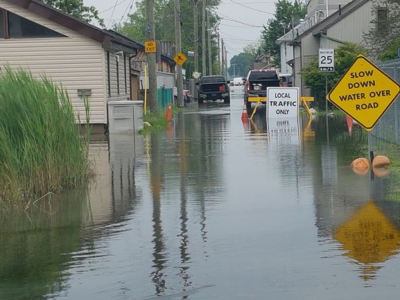
If water over the road is encountered, motorists are reminded to drive with caution and slow down. If possible, avoid the area. Vehicles can create wakes that will cause damage to property and other vehicles on the road.
The combination of slippery banks, waves, waves overtopping shoreline structures, and fast moving water can be dangerous. Standing water can also present its own unseen hazards. Children, pets, and livestock should be kept away from flowing or standing water as well as shoreline areas.